ANCHOR BAY
WATERSHED
About the Anchor Bay Watershed
Jump to Section:
Watershed Location and Size
Located in both St. Clair and Macomb Counties, the Anchor Bay watershed is part of the Lake St Clair drainage system. This watershed is composed of 171 square miles of land and 473 miles of waterways. Ten islands, including Harsens and Dickenson Islands, are formed where the St. Clair River meets Algonac Bay, forming the largest freshwater delta in the Great Lakes.
Watershed Wildlife
The Anchor Bay watershed contains 38,000 acres of ecologically sensitive land. The majority of this land is composed of wetlands which are critical for conserving fish and wildlife species. One-hundred seventeen fish species are either permanent residents of Anchor Bay or visit to spawn. In addition, many species of waterfowl are also found in this watershed, with Anchor Bay identified as one of the best duck hunting spots in the state.
Many tributaries of the Anchor Bay watershed are home to small populations of lake sturgeon. The largest fish of the Great Lakes, lake sturgeon are known as "living fossils" due to their slow rate of evolution. Lake sturgeon are threatened in many Great Lakes states, including Michigan, due to problems such as overharvesting and habitat loss.


Watershed History
The Anchor Bay watershed was originally dominated by upland forest and lakeplain prairie. The federal Swamplands Act of 1850 provided wetland parcels at no cost to individuals if they agreed to convert them to useful land. By 1873, settlers had converted almost all of the natural landscape to agriculture. Improved transportation also encouraged more settlement and development through railways and dredging in Lake St. Clair. Development intensified further in the 1950s, and by the mid-1970's, most of Lake St. Clair's shoreline was fully developed.
Anchor Bay Watershed Health
Water Monitoring
Most of the flow into Anchor Bay is from the north channel of the St. Clair River, but can shift depending on wind conditions. The major tributary streams of this watershed include Auvase Creek, Beaubien Creek, Crapeau Creek, Marsac Creek, Swan Creek, the Marine City Drain, and the Salt River.
Anchor Bay has one of the densest mayfly populations in southeast Michigan. Though sometimes viewed as a nuisance, they serve an important role in the food chain and are indicators of healthy water due to the aquatic larvae's pollution intolerance. The mayfly is just one of the 300 types of macroinvertebrates (bugs) that live in Anchor Bay that serve as an important food source for larger fish and other animals.
We learn a lot about the water quality of the Anchor Bay watershed from the organisms that live in its waters. Benthic macroinvertebrates (bugs that live at the bottom of a water body) can indicate whether a water body is healthy or polluted. Friends of the St. Clair River monitored the benthic macroinvertebrates in the Anchor Bay watershed in the past with our Stream Leaders program (now called Stream Team). In 2011, monitoring of Meldrum Creek revealed a rating of "Good", and monitoring of Beaubien Creek resulted in a "Fair" rating. Learn more about Stream Team and join us in monitoring the quality of our waters.
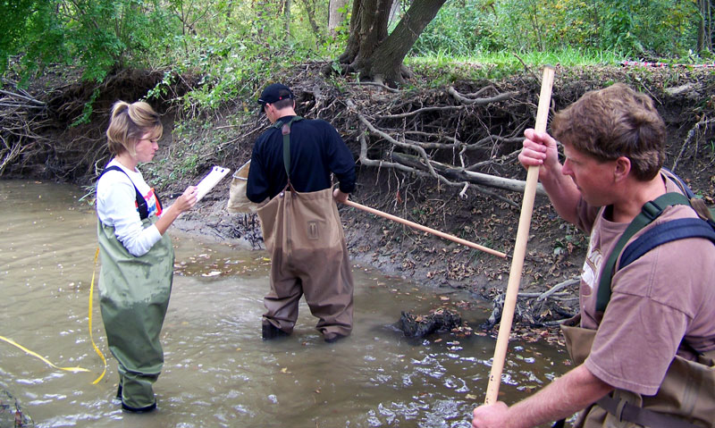
The Stream Team surveys the watershed to assess water quality.
Successes
- Stormwater management programs by municipalities in the Anchor Bay Watershed system has been a great success in reducing nonpoint source pollution created by stormwater runoff.
Challenges
The Anchor Bay watershed has portions with impaired water quality due to a variety of human-caused actions:
- Elevated E. coli concentrations due to runoff from agricultural manure use, sanitary sewer overflows, and failing septic systems.
- Excessive nutrients due to overuse of fertilizers.
- Low dissolved oxygen levels from soil erosion and increased temperature from riparian removal reduce habitat quality for aquatic organisms.
- Invasive species lower habitat quality and threaten native species at risk of extinction.
- Anticipated increase in land development is expected to increase impervious surface coverage which exacerbates stormwater pollution.
Action
St. Clair County identified multiple Best Management Practices for implementation within the watershed to improve water quality of the Anchor Bay watershed. Such practices include:
- Replacing or eliminating failing septic systems.
- Implementing stormwater ordinances.
- Erecting exclusion fences to prevent livestock from contributing to streambank erosion and fecal contamination.
- Restoring in-stream and shoreline habitat.
Anchor Bay Watershed Recreation
Recreation
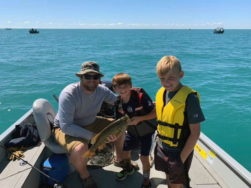
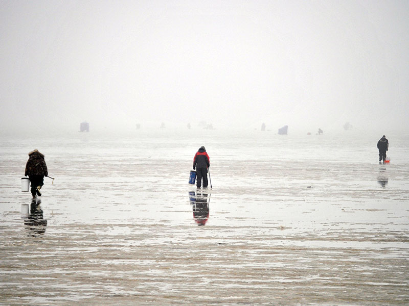
Boating, kayaking, swimming, and fishing are all common activities in Anchor Bay, including ice fishing during the winter. With Anchor Bay's 117 fish species, you are bound to catch something that you like.
Hunting is a popular activity, as the watershed is known as one of Michigan's premiere duck hunting areas.
Walking and cycling opportunities are also available along the Bridge to Bay Trail.
Birding is a popular activity, with many migrant waterfowl temporarily residing in Anchor Bay. The St. Clair-Macomb Birding Trail is partially located in the Anchor Bay watershed.
Public recreation access is plentiful in the Anchor Bay Watershed!
Check out some of these favorite locations:
- Algonac State Park
- Clair Flats State Wildlife Area in Clay Township
- Johns Marsh in Clay and Ira Townships
- Ira Township Park
- Pollard Park Nature Area in Chesterfield Township
- Brandenburg Park in New Baltimore
- New Baltimore Beach

The Krispin Drain is a popular Blueways kayaking destination.
Watershed Management Plan
Watershed planning is rooted in achieving the best water quality possible for Michigan’s waters. The goal of a Watershed Management Plan is to prioritize the sources of water quality pollutants, assess historical changes the watershed has undergone, and identify future water and land use challenges. Since 2005, the St. Clair County Health Department has led watershed management planning efforts to assess current water quality conditions and identify projects that will help protect and restore our natural resources. The following links below include the Watershed Management Plan for Anchor Bay.
Watershed Advisory Groups were formed to assist with the development of these plans comprised of citizens, organizations, agencies, and municipalities that have jurisdiction over land use and stormwater. As a result, these plans have prioritized projects and actions needed to restore, enhance, and protect St. Clair County’s rivers, tributaries, and headwaters.

Chapter 1 – State of the Anchor Bay Watershed
Chapter 2 – Public Participation and Education Strategy
Chapter 3 – Watershed Goals and Objectives
Chapter 4 – Actions And Best Management Practices
Chapter 5 – Subwatershed and Community Action Plans
Chapter 6 – Methods Of Measuring Progress
Chapter 6 – Addendum