BELLE RIVER
WATERSHED
About the Belle River Watershed
Jump to Section:
Watershed Location and Size
With headwaters located in Lapeer County, the Belle River encompasses 227 square miles of land, running through portions of Lapeer, Macomb, and St. Clair Counties. Its mouth opens to the St. Clair River in Marine City and marks the southernmost US tributary to the binational St. Clair River.
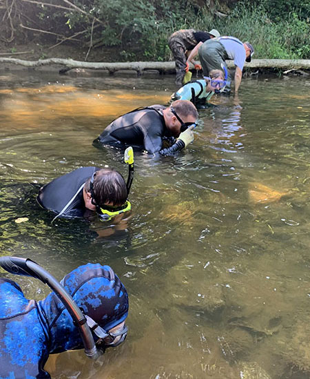
Biologists and volunteers conduct a freshwater native mussel survey on the Belle River in Columbus Township. (2020)
Watershed Wildlife
The Belle River supports a high diversity of freshwater mussels including some rare species. A survey of the mussel species in the watershed found 27 unique species, four of which are considered threatened or endangered.
The state threatened eastern sand darter also calls the Belle River home. This small, minnow-like fish is found in sandy, low flowing stream bottoms. Siltation from erosion threatens this species’ habitat and is the largest contributor to the sand darter’s decline.


Watershed History
The Belle River watershed was historically comprised of 60% upland forest and 40% wetland. Between 1800 and 2005, settlement of the area reduced the original natural landscape to 25% of the watershed, replacing it with a mix of agricultural and urban land uses. As Marine City established and grew, the original Belle River delta was dredged in 1902 by the Army Corps of Engineers creating a deep river mouth to enhance navigation by ships.

The newly-dredged mouth of the Belle River allowed for passage of large water vessels.
Belle River Watershed Health
Water Monitoring
We learn a lot about the water quality of the Belle River from the organisms that live in it. Benthic macroinvertebrates (bugs that live on the river bottom) can indicate whether the water body is healthy or polluted. Friends of the St. Clair River regularly monitors benthic macroinvertebrates in the Belle River in our semi-annual Stream Team excursions and the winter Stonefly Search. Current monitoring suggests that the Belle River is considered to have some of the best water quality in our area.
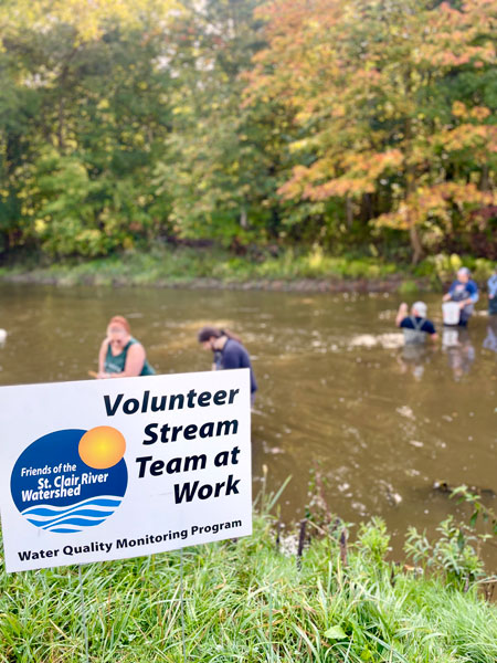
Volunteers survey the Belle River to assess water quality.
Successes
- Control structures are now being installed in farm fields to limit nutrient runoff that contributes to algae blooms.
- Bank stabilization projects, such as found in Columbus County Park and Belle River Park limit soil erosion and help reduce water temperatures which lead to an increase in dissolved oxygen in the water column.
Challenges
Portions of the Belle River have impaired water quality due to a variety of human-caused actions:
- Low dissolved oxygen levels from soil erosion and increased temperature from riparian removal reduce habitat quality for aquatic organisms.
- Bacteria concentrations from failing septic systems and animal waste can be a concern for swimming and other body-contact uses.
- Mercury deposition from atmospheric deposition.
Illicit dumping of industrial waste and industrial runoff also remain challenges in some portions of the Belle River.
Action
- St. Clair County identified multiple Best Management Practices for implementation within the watershed to increase water quality of the Belle River. Such practices include:
- Planting cover crops to prevent erosion,
- Erecting exclusion fences to prevent livestock from contributing to streambank erosion and fecal contamination,
- In-stream and shoreline habitat restoration.
Belle River Watershed Recreation
Recreation
Larger boats can navigate the deep portion of the river near the mouth, whereas kayaks and other small, personal watercraft can navigate upstream waters.
Fishing is common along the Belle River containing both a cold water and warm water fishery. Creek chubs are found near the upper portions of the river and rainbow trout were historically stocked in the region near Memphis. Warm water fish including sunfish, smallmouth bass, rock bass, catfish, and suckers are found near the mouth.
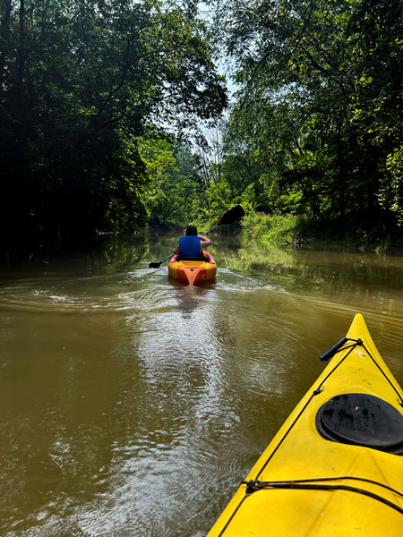
Kayaking is one of the many recreational activities available on the Belle River.
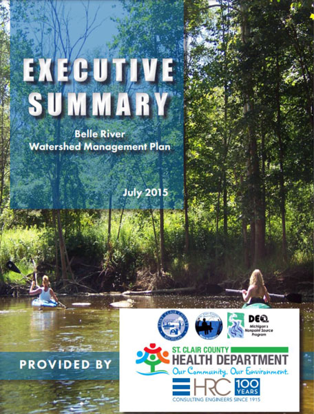
Watershed Management Plan
Watershed planning is rooted in achieving the best water quality possible for Michigan’s waters. The goal of a Watershed Management Plan is to prioritize the sources of water quality pollutants, assess historical changes the watershed has undergone, and identify future water and land use challenges. Since 2005, the St. Clair County Health Department has led watershed management planning efforts to assess current water quality conditions and identify projects that will help protect and restore our natural resources. The following watershed management plan was created for the Belle River.
Watershed Advisory Groups were formed to assist with the development of these plans comprised of citizens, organizations, agencies and municipalities that have jurisdiction over land use and stormwater. As a result, these plans have prioritized projects and actions needed to restore, enhance, and protect the St. Clair River Watershed’s rivers, tributaries, and headwaters.
Cover Page - Cover Page & Table of Contents
Chapter 1 - Watershed Description
Chapter 2 - Water Quality Conditions
Chapter 3 - Prioritized Pollutants, Critical Areas, and Priority Areas
Chapter 4 - Designated & Desired Uses
Chapter 5 - Watershed Goals
Chapter 6 - Best Management Practices
Chapter 7 - Watershed Action Plan
Chapter 8 - Public Education Plan
Chapter 9 - Evaluation Plan