LAKE HURON
WATERSHED
About the Lake Huron Watershed
Jump to Section:
Watershed Location and Size
The Lake Huron watershed comprises a narrow strip of land along the eastern edge of the thumb where all the water that reaches the ground drains directly into Lake Huron. This 203 mi2 stretch of land starts in Fort Gratiot, MI and extends 43 miles northward and includes the towns of Lexington and Port Sanilac.
Watershed Wildlife
Plentiful lake sturgeon swim in the deeper waters along the shoreline as they migrate from the St. Clair River to other reaches of the Great Lakes. Inland, the endangered painted trillium can be found hidden in woodlands along Lake Huron.
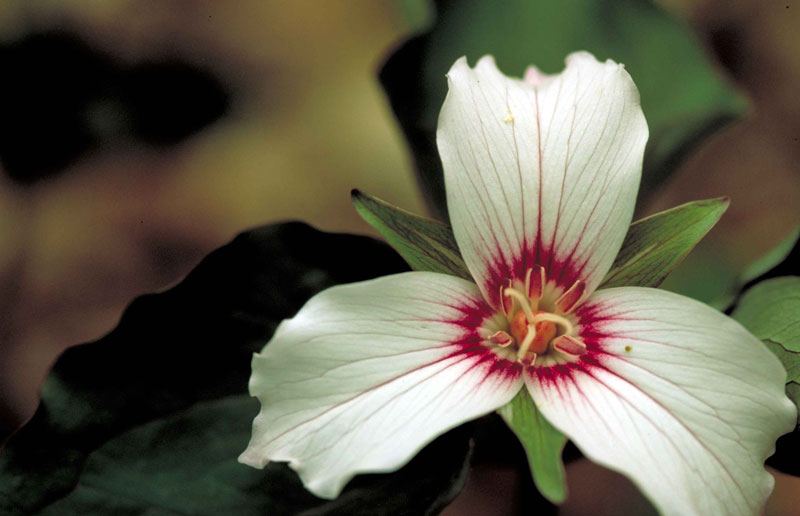
Endangered painted trillium


Watershed History
Prior to European settlement, the forests along Lake Huron watershed offered a plethora of fish and game, wild fruits, and herbs. However, in the early 1800s, the landscape began changing as settlers cleared the land for the logging industries. As the forests disappeared, much of the land transitioned to agricultural purposes with residential homes lining the shoreline.

DO YOU HAVE A HISTORIC PHOTO?
Lake Huron Watershed Health
Water Monitoring
Non-point source pollutants are the primary concern for the watershed along the Lake Huron. Such pollutants include:
- Excess nutrients from failing septic systems, lawn and garden activities, and agricultural runoff.
- Sediment from agricultural runoff, channelized drainage, new development, and dirt/gravel roadways create silty waterways that blankets important in-stream habitat for fish and macroinvertebrates.
- Chemicals and pesticides can find their way into the water from leaking landfills or historically contaminated sediments. Improper application of chemicals by residential, commercial, or agricultural producers may cause excess products to runoff into the waterways.
- Flashy hydrology increases with land development due to increased impervious surfaces, and stream channelization.
- Bacteria from failing septic systems, unrestricted livestock access to water, and large congregations of geese and seagulls.
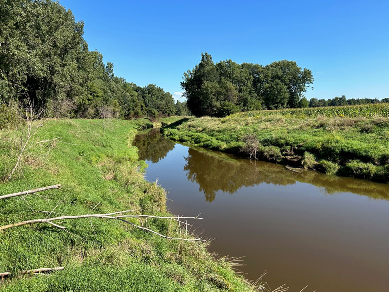
Agricultural fields to the river’s edge along with channelization lead to increased erosion potential and flashy hydrology.
Successes
- Conservation programs exist for landowners to partner with federal, state, and local agencies to preserve and enhance riparian buffers adjacent to streams that flow directly into Lake Huron to control runoff.
- Current research is focusing on using controlled drainage to reduce phosphorus loss from agricultural fields, protecting both a farmer’s investment and the watershed.
A stream that flows directly into Lake Huron
Challenges
- Failing septic systems are a contributing factor for excess nutrient and bacteria loads into Lake Huron.
- Runoff, sedimentation, and bacteria loads from livestock continue to contribute to non-point source pollution.
Action
- Extensions of federal and state programs to increase partnerships with the agricultural community would greatly benefit the watershed.
- Fencing livestock out of streams prevents erosion and excess nutrient and bacteria release.
- Maintaining green infrastructure including rain gardens or buffer strips containing native vegetation helps control erosion and stabilize riverbanks.
Lake Huron Watershed Recreation
Recreation
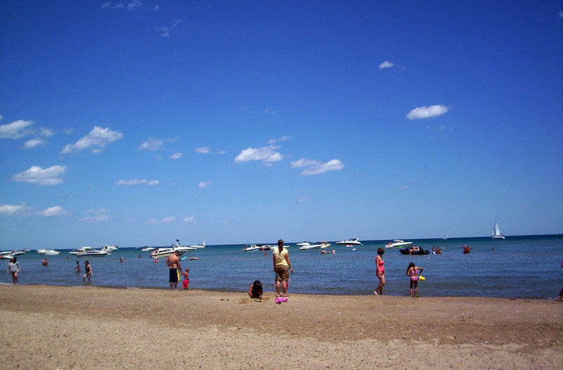
The clear blue water of Lake Huron draws recreationists from near and far. The following activities are enjoyed by many visitors:
- Multiple parks and campgrounds can be found along Lake Huron, offering ample green space and public access to the water.
- Kayaking, canoeing, paddleboarding, and scuba diving are popular water sports for many recreationists.
- Lake Huron is a hotspot for boating and sailing.
- Fishing is tremendous year-round, with ample catches of walleye, salmon, perch, and whitefish.
Watershed Management Plan
Watershed planning is rooted in achieving the best water quality possible for Michigan’s waters. The goal of a Watershed Management Plan is to prioritize the sources of water quality pollutants, assess historical changes the watershed has undergone, and identify future water and land use challenges. Since 2005, the St. Clair County Health Department has led watershed management planning efforts to assess current water quality conditions and identify projects that will help protect and restore our natural resources. St. Clair County’s Management Plan for Lake Huron’s Watershed can be found below as part of the Northeast Watershed Management Plan.
Watershed Advisory Groups were formed to assist with the development of these plans comprised of citizens, organizations, agencies and municipalities that have jurisdiction over land use and stormwater. As a result, these plans have prioritized projects and actions needed to restore, enhance, and protect the St. Clair River Watershed’s rivers, tributaries, and headwaters.
DO YOU HAVE A COVER GRAPHIC?